Unstable atmospheric phenomena could even cause a tornado
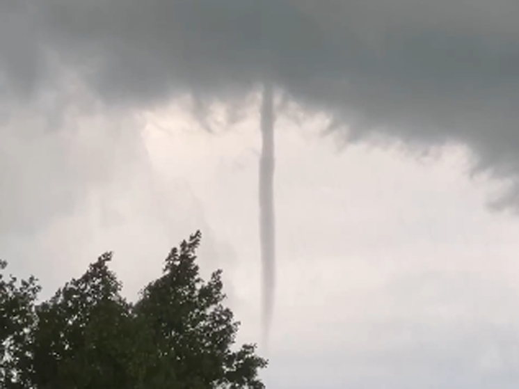
Moscow was attacked by a tornado on June 6, the Telegram channel «What's going on in Moscow» reported. According to bloggers, the whirlwind swept over the Kaluga Highway at about 6 p.m. in the form of a dark trunk hanging from a cloud but not reaching the ground. Scientific Director of the Hydrometeorological Center of the Russian Federation Roman Vilfand told MK that the unstable phenomena observed in the atmosphere this week could theoretically contribute to the formation of strong vortices over the city.
According to the weather forecaster, now in Moscow there is a very strong instability in the atmosphere, which is intensified by the sun's rays, which have colossal energy on the eve of the summer solstice, which will come on June 21.
– We issued a storm warning for Thursday, June 6: from 12 noon until the end of the day, very heavy rain, thunderstorms, hail, and winds up to 20 meters per second were forecast, – says Roman Mendelevich. – The word “very” always denotes a dangerous phenomenon. In this case, we were talking about a large amount of precipitation, exceeding the threshold value. After such precipitation, there are threats to the functioning of the city in the form of streams of water and poor visibility on the roads.
According to Vilfand, the same cyclone greatly surprised meteorologists on June 5: at about 10 o’clock, an unprecedented amount of precipitation fell in the entire history of meteorological observations in the capital. At the VDNKh station, more than 45 millimeters of precipitation were recorded in 20 minutes.
“Such downpours don’t always happen even in the tropics,” says the scientist. – But ours was local, on a scale of several kilometers. For example, in the area of the Ostankino Tower at the same time there was only 20 mm, the Balchug station generally recorded only 3 mm, and in Sheremetyevo — not a drop. Here's Moscow for you!
The city is now under the influence of a low pressure trough. What does it mean? Air masses move vertically, from the surface of the earth upward. But since the cloudiness is not continuous, an additional effect arises for the rise of air masses: the sun bakes the soil, but not everywhere. For example, in peat bogs, heating of the underlying surface occurs very quickly, causing warm, light air to rapidly rise upward. This is called explosive convection. Then, according to the laws of physics, condensation of water vapor occurs, rapid cloud formation and heavy rains.
Convection processes and heating of the underlying surface, according to the forecaster, were joined this week by a third factor: frontal sections passing through the center , so-called secondary fronts, which further enhance convection.
“When three factors come together, phenomena associated with very heavy and local rains arise,” says Vilfand.
“I still need to check the information about tornado. But in principle, it is possible given the factors mentioned above. Its formation may also be due to the fact that air masses, due to fragmented cloud cover, warm the territory unevenly.

















Свежие комментарии